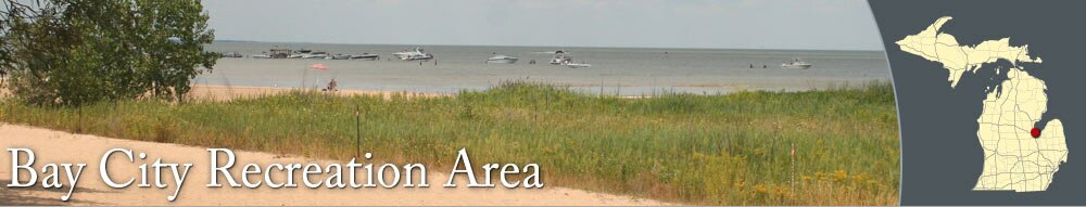
Just north of Bay City, the Bay City Recreation Area features a long, sandy beach on Saginaw Bay. Swimmers and sunbathers love the freshwater beach, which also attracts area boaters, who often anchor their boats offshore and visit the park. The Recreation Area has over a mile of beautiful shoreline.
The park's biking, hiking, and cross-country skiing trails wind around the park, past an inland lake and acres of marshland. The trails link to wildlife viewing areas and observation towers, which are great spots to see a variety of migratory birds.
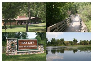
Bay City Recreation Area has a few large picnic shelters and areas with picnic tables. Near the center of the park, there is a large playscape that resembles a wooden fort.
The Saginaw Bay Visitor Center, which is accessible from the main entrance off Beaver Road, has helpful information about the park and the Bay City area.
North of the Visitors Center, there is small inland lake that features a fishing pier for catching small fish.
The park has a large modern campground and an organizational campground, which are both located on the southside of Beaver Road. The modern campground offers electrical service and modern restrooms. For campground reservation information, visit the
DNR's web site.
Bay City and Wilder Road is approximately 4 miles from the park. Wilder Road has many restaurants and stores, including Bay City Mall. Downtown Bay City is about 7 miles from the Recreation Area. Downtown has many historic buildings, unique shops, pubs, and more.