|
|
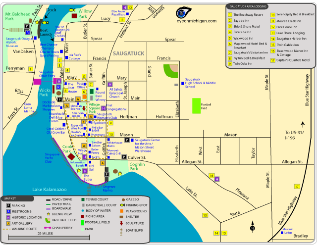
Downtown Saugatuck Map (Online version)
Downtown Saugatuck Map (PDF)
Walking Route included: many historic locations, shops, art galleries, parks and more are within walking distance in downtown Saugatuck.
Parks included: Coghlin Park, Cook Park, Mt. Baldhead Park, and Village Square Park in Saugatuck.
Also shows the locations of motels, bed and breakfasts, shops, restaurants, marinas, fishing spots, and more in Saugatuck, Michigan.
|

|
|
|
Saugatuck Area Map (Online version)
Saugatuck Area Map (PDF)
Beaches included: Oval Beach in Saugatuck and Douglas Beach.
Trails included: the South Ridge Trail at Mt. Baldhead Park is used for hiking. A boardwalk along Lake Kalamazoo is located in downtown Saugatuck near Cook Park. There is a paved trail on the north side of Blue Star Highway.
Parks included: Coghlin Park, Cook Park, Mt. Baldhead Park, and the park land along Butler Street in Saugatuck. The map also shows Beery Field, Douglas Beach, and Wade's Bayou in Douglas.
Also shows West Shore Golf Club, Saugatuck-Douglas Historic Museum, Ox-Bow School, Singapore Yacht Club, Tower Marine, Saugatuck Yacht Club, Saugatuck Center for the Arts, Park House Inn, SS Keewatin Museum, Lake Kalamazoo Lighthouse, and other locations in Saugatuck, Michigan. The map also shows some locations of Douglas.
|