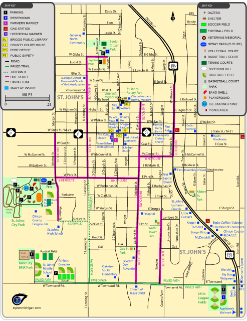
St. Johns Map
Download the higher resolution PDF version:
St. Johns Map (PDF)
Bike Routes shown: St. Johns has a few streets with bike lanes. Where there isn't a bike lane, the streets indicated as bike routes are typically wide enough for bikes to ride on the outer edge of the street.
Trails included: On the south side of St. Johns, there are wide concrete paths along Townsend Road that are used for biking, walking, and jogging. A path is also along part of Lansing street; the path turns in to sidewalk. At St. Johns Park, there are hiking trails that wind through the wooded area of the park. Mountain bikers can use the BMX hills at Mint City BMX Park.
Parks included: Kibbee Street Park, Little League Fields on Townsend Road, Mint City BMX Park, Oak Street Park, Senior Citizen Park, St. Johns City Park, St. Johns Jaycees City Park, St. Johns Rotary Park, and Veteran's Memorial.
Also shows the Clinton County Historical Society Museum, Clinton Northern Railway Museum, Briggs Public Library, municipal locations, restaurants, stores, schools, and more in St. Johns, Michigan.