
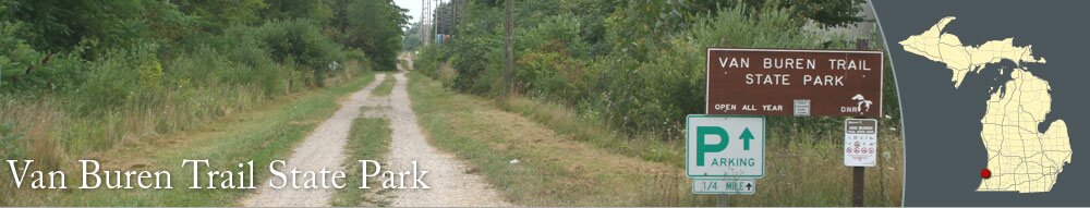
Van Buren Trail State Park is a recreational trail that stretches from South Haven to Hartford. The trail can be used for mountain biking, hiking, jogging, horseback riding, and snowmobiling. The nortnern part near South Haven is paved, with a trail spur that goes the Van Buren State Park. The rest of the trail is a combination of dirt, gravel and grass (except when it is snow-covered). The trail is best suited for mountain bikes since the terrain can be pretty rugged.
The trailhead in South Haven is located off Lovejoy Avenue, east of JR Monroe Boulevard. A one-way drive leads toward a parking lot that is about a couple hundred feet from Lovejoy Avenue. For a close-up map of the South Haven trailhead, see the South Haven Parks & Trails section.
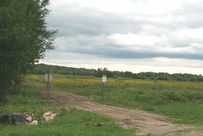
The trailhead in Hartford is off of Prospect Street. The most direct from downtown Hartford to the trail head is to take Center Street north past Main Street. The fifth street on the left will be Prospect Street. Just past the railroad tracks, the trailhead drive will be on the left side of the road. There isn't a formal parking lot at the trailhead, just a grass/dirt area.
The trailhead in South Haven is located off Lovejoy Avenue, east of JR Monroe Boulevard. A one-way drive leads toward a parking lot that is about a couple hundred feet from Lovejoy Avenue. For a close-up map of the South Haven trailhead, see the South Haven Parks & Trails section.
The trailhead in Hartford is off of Prospect Street. The most direct from downtown Hartford to the trail head is to take Center Street north past Main Street. The fifth street on the left will be Prospect Street. Just past the railroad tracks, the trailhead drive will be on the left side of the road. There isn't a formal parking lot at the trailhead, just a grass/dirt area.


|
|